West Kameng district
High-Altitude Valleys and Buddhist Traditions
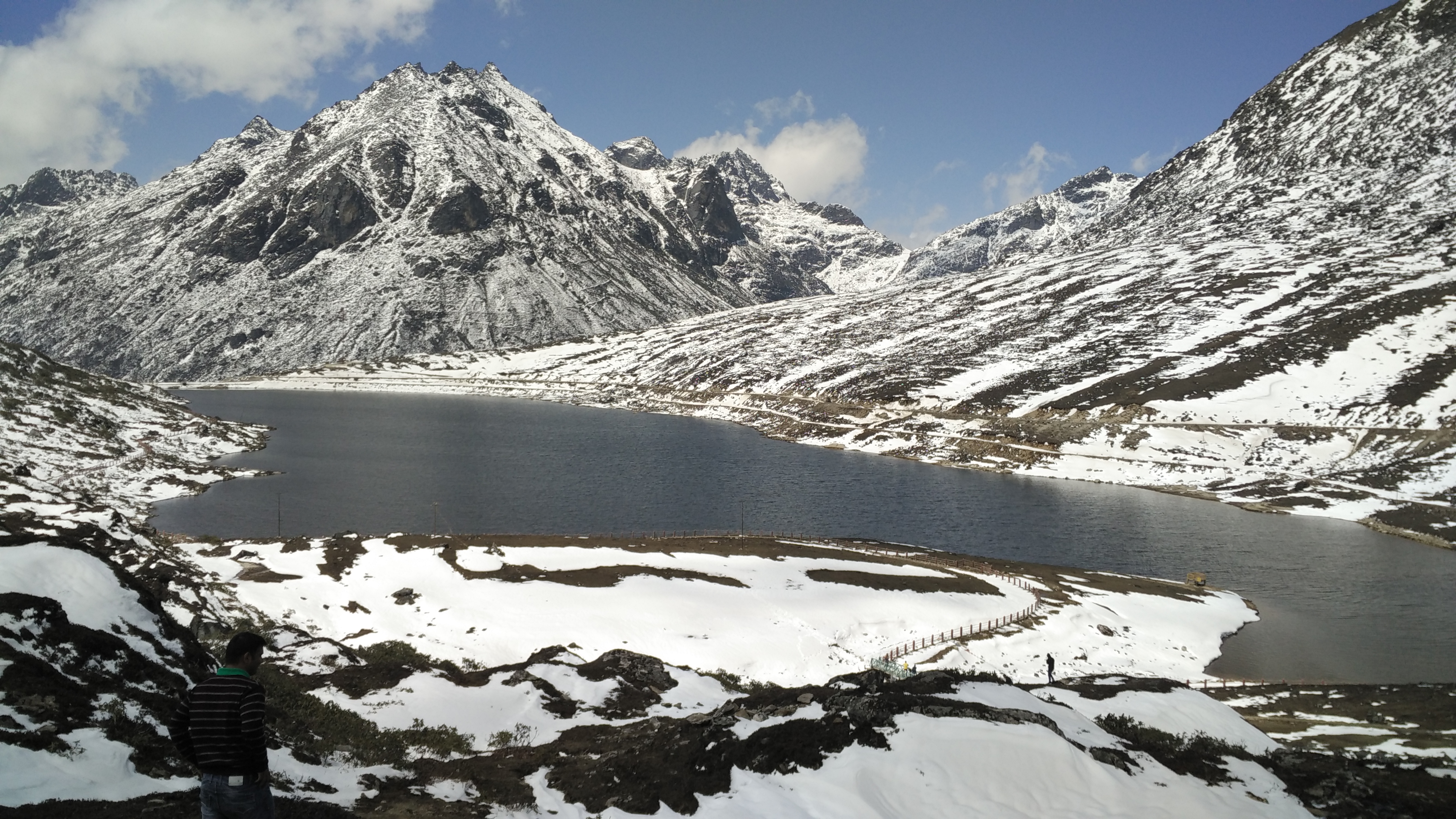
West Kameng district lies in the western part of Arunachal Pradesh, characterized by its mountainous terrain, deep river valleys, and significant Buddhist cultural footprint. The district headquarters, Bomdila, sits at an elevation that offers panoramic views of the surrounding Himalayan ranges. The landscape transitions from sub-tropical forests at lower elevations to alpine meadows and snow-capped peaks further north.
History & Context
The region that now forms West Kameng has historically been influenced by Tibetan Buddhism, evident in the monasteries and cultural practices of the Monpa, Sherdukpen, and Miji communities. Before its current administrative structure, the area was part of the greater Kameng Frontier Division during the British era and later under independent India's North-East Frontier Agency (NEFA). The present district was carved out of the larger Kameng district in 1980. Its strategic location near the international border has shaped its historical narrative, with layers of trade routes connecting it to Tibet.
What Makes It Distinctive
West Kameng is distinct for its blend of diverse tribal cultures and natural biodiversity. The Monpa people, indigenous to the region, are known for their vibrant mask dances, traditional Thangka painting, and the production of a particular variety of paper made from the bark of the Daphne plant. This handmade paper, often used for religious texts and official documents, is a craft passed down through generations. The district is also home to Eaglenest Wildlife Sanctuary, a biodiversity hotspot renowned globally for its birdlife, including the Bugun Liocichla, a species discovered only in 1995. The Sessa Orchid Sanctuary hosts over 200 species of orchids, many of which are endemic to the Eastern Himalayas, making it a crucial site for botanical enthusiasts and researchers alike.
Best Time to Visit
The optimal time to visit is from October to April. During October and November, the weather is clear and cool, offering unobstructed mountain views and pleasant conditions for outdoor activities. December to February can be very cold, with snowfall in higher reaches, appealing to those who enjoy winter landscapes. March and April see rhododendrons and other mountain flora in bloom, and the weather becomes milder before the monsoon season arrives from May to September. Monsoons bring heavy rainfall, making travel challenging due to landslides and poor road conditions.
How to Reach
By Air: The nearest major airport is Lokpriya Gopinath Bordoloi International Airport (GAU) in Guwahati, Assam, approximately 320 km from Bomdila. From Guwahati, one can hire a taxi or take a shared vehicle. Another option is Tezpur Airport (TEZ) in Assam, about 160 km from Bomdila, with more limited flight connectivity.
By Rail: The nearest railhead is Rangapara North Railway Station (RPR) in Assam, approximately 144 km from Bomdila. This station connects to major cities like Guwahati. From Rangapara North, taxis and shared jeeps are available.
By Road:
- Guwahati to Bomdila: ~320 km / ~10-12 hours via NH15 and NH13. The route typically passes through Tezpur and Bhalukpong.
- Tezpur to Bomdila: ~160 km / ~6-7 hours via NH13. This is the most common entry point into West Kameng for those arriving by air or rail at Tezpur.
- Itanagar to Bomdila: ~300 km / ~10-11 hours via NH13.
Permits & Entry
For Indian Nationals: An Inner Line Permit (ILP) is mandatory to enter Arunachal Pradesh. These can be obtained online from the official Arunachal Pradesh government website, or in person from Resident Commissioner offices in major cities like Kolkata, Guwahati, Shillong, Delhi, and Tezpur.
For Foreign Nationals: A Protected Area Permit (PAP) is required. This permit can be obtained from the Ministry of Home Affairs (MHA), Government of India, or through registered tour operators. PAPs are generally issued for a maximum of 30 days for groups of two or more foreigners. Individuals may receive them under specific circumstances. Information is not officially published or may change. Visitors are advised to confirm locally before travelling. Specific permits may also be required for entry into Eaglenest Wildlife Sanctuary or Sessa Orchid Sanctuary; these are typically managed at the sanctuary entry gates. Entry fees and timings for protected areas: Information is not officially published or may change. Visitors are advised to confirm locally before travelling.
Nearby Attractions
- Dirang: A picturesque valley town, known for its hot springs and the Dirang Dzong, an ancient fort. Approximately 42 km from Bomdila.
- Tawang: The renowned Tawang Monastery, one of the largest Buddhist monasteries in the world, is a significant spiritual and cultural center. Approximately 170 km from Bomdila.
- Bhalukpong: The entry point to Arunachal Pradesh from Assam, situated on the banks of the Kameng River, offering opportunities for angling and riverside picnics. Approximately 100 km from Bomdila.
- Sessa Orchid Sanctuary: Hosts a diverse collection of orchid species, vital for botanical research and appreciation. Located near Bhalukpong.
- Eaglenest Wildlife Sanctuary: A premier birding destination, recognized for its exceptional avian biodiversity including rare endemic species. Adjoining Sessa Orchid Sanctuary.
Traveller Tips
- Connectivity: Mobile network coverage (especially for data) can be erratic. BSNL generally works better than private operators in remote areas. Expect limited or no connectivity in some parts.
- ATMs & Cash: ATMs are available in Bomdila and Dirang, but it is advisable to carry sufficient cash, especially for purchases in smaller villages or for local transport. Many establishments do not accept digital payments.
- Altitude Sickness: Bomdila is at approximately 2,415 meters. Those travelling to higher altitudes like Tawang should acclimatize in Bomdila for a day or two to avoid altitude sickness. Stay hydrated.
- Dress Code: Given the culturally sensitive nature of the region, modest clothing is recommended, particularly when visiting monasteries or local homes. Warmer layers are essential throughout the year, with heavy woollens needed for winter.
- Ethical Photography: Always seek permission before photographing people, especially monks or during religious ceremonies. Be mindful of cultural sensitivities.
- Accommodation: Options range from government guesthouses and basic hotels in Bomdila and Dirang to simpler homestays in remote villages. Book in advance, particularly during peak season.
- Road Conditions: Roads can be challenging, especially during monsoon season, with possibilities of landslides and prolonged travel times. Allow for buffer time in travel plans.
- Language: While Hindi is widely understood, learning a few basic phrases in Monpa or Sherdukpen can enhance interactions with local communities and show respect.
Frequently asked
Related
Plan Your Journey with Living Roots Expeditions
Travel Northeast India with a private guide, hand-picked hosts, and an itinerary shaped around your interests — culture, wildlife, festivals, or slow discovery. If this subject is why you are travelling, see our Northeast India tour packages.